The Great Plains Trails Network strives to bring you the most up-to-date information on our area trails. Use the map below to start your trail adventure.
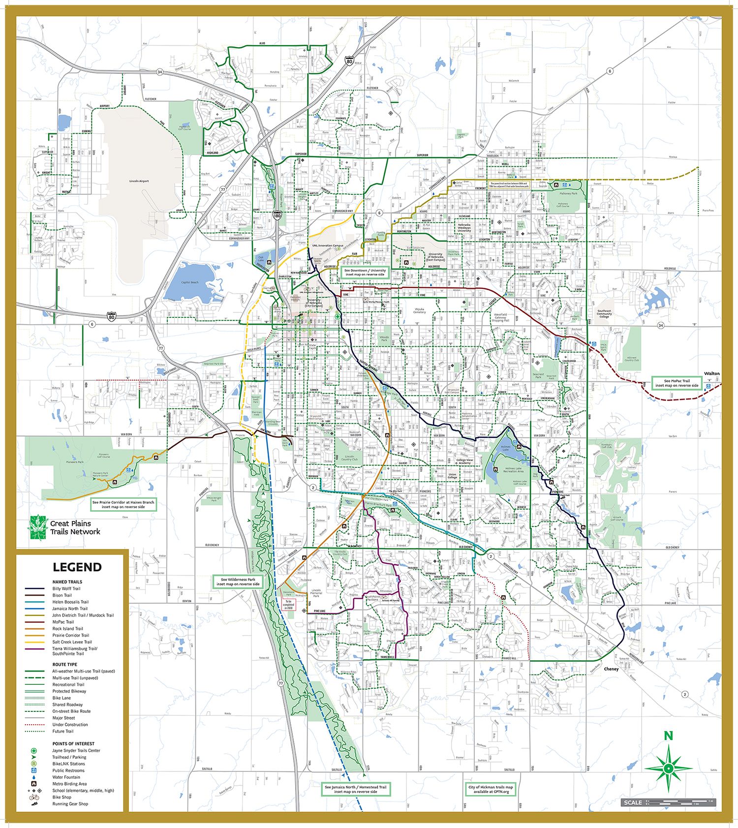
You can use the Ride with GPS interactive map to get an overview of the routes, and many of those routes are linked directly here and on individual GPTN route pages. You can open, preview, or send them to your device after downloading the free app. If you prefer something you can hold in your hands, we’ve also included a PDF copy of the full trail map, which you can pick up around the city at places like local bike shops and the Jayne Snyder Trail Center in Lincoln.
You’re also in luck, because the City of Lincoln offers its own dedicated trail‑mapping system that lets you plan your trip in detail, and the Lower Platte South NRD provides another excellent map resource for exploring recreation areas and connecting trails. Between GPTN’s maps, the city’s planning tools, and the NRD’s recreation maps, you have everything you need to choose your route, discover new paths, and enjoy the incredible trail network waiting for you.